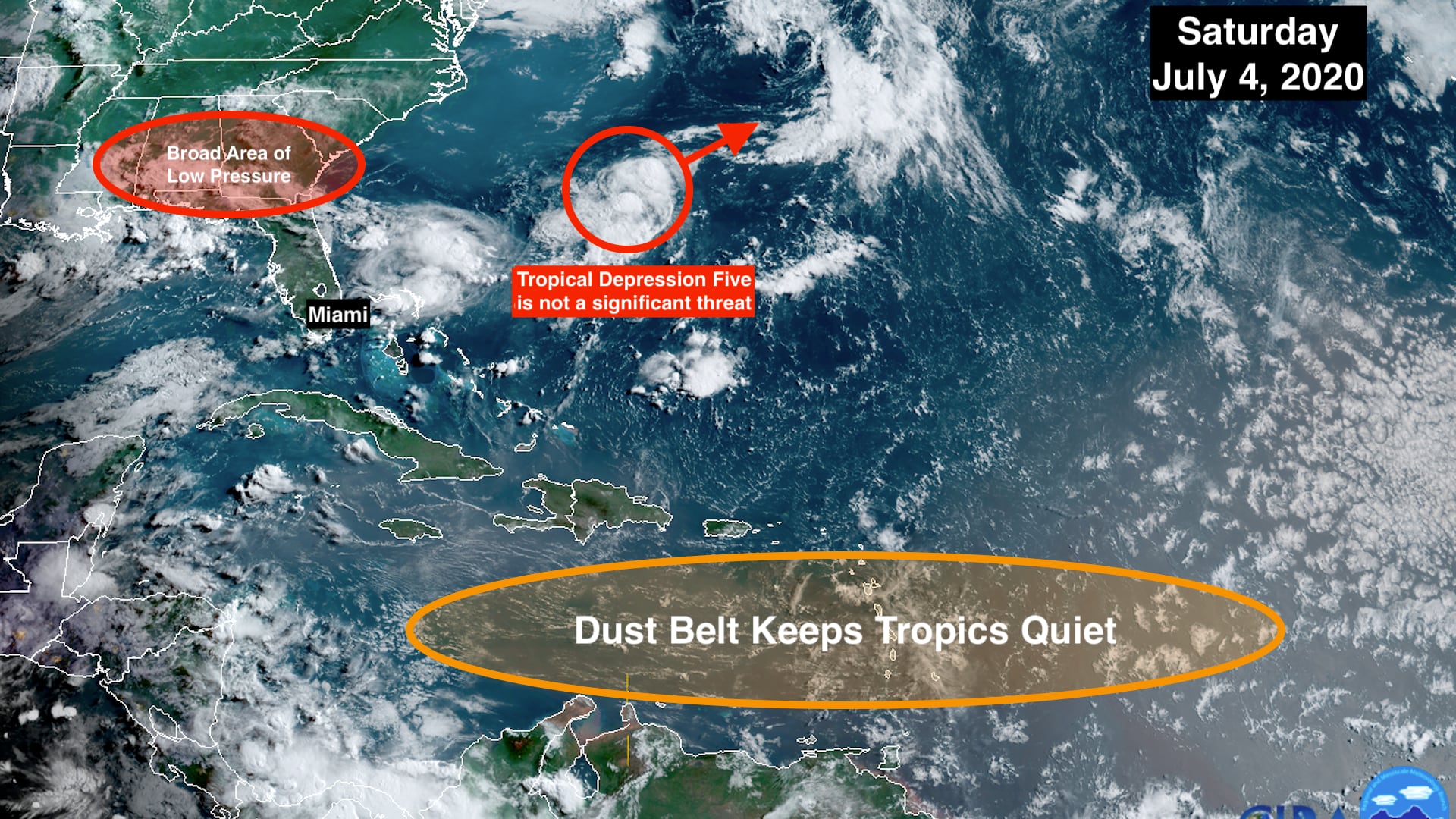
Some things have changed over the last week, but the dust remains. A belt of Saharan Dust continues to create hostile atmospheric conditions from Africa across the tropical Atlantic, the Caribbean, and into the Gulf of Mexico. As a result, no development is expected in that zone through much or all of next week.
Farther north in the Atlantic, the National Hurricane Center had designated a small circulation well off the Southeast U.S. coast as Tropical Depression Five. It started as a cluster of thunderstorms – a daughter system – from a broad area of low pressure that has set up across the Southeast.
There’s a decent chance it will briefly develop into Tropical Storm Emily over the next day or so as quickly moves out into the ocean. Eventually, it will get absorbed by a large low-pressure system moving across the North Atlantic.
The only land that might be affected would be Bermuda. It is not expected to be very strong, however.

That same broad low-pressure area over the Southeast has changed the weather pattern over South Florida just enough to allow thunderstorms to develop each day and move toward the Atlantic coast. The clouds and storms are taking the edge off the heat- yay! Conditions conducive for thunderstorms to develop should increase over the next couple of days, and be with us for the foreseeable future.
There is a light layer of Saharan Dust in the atmosphere over South Florida. It’s not enough to stop the thunderstorms, but instead it can make them more intense when they pop up – including very gusty winds and hail.
Happy 4th of July! Stay safe.
Copyright 2020 by WPLG Local10.com - All rights reserved.


