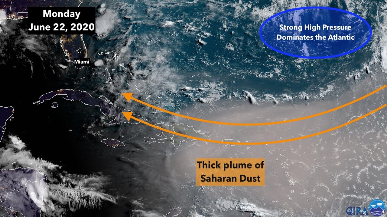
The milkiness of the skies over South Florida will increase this week as the edge of a thick plume of dust from the Sahara Desert in Africa reaches our shores. We should start to notice the plume tomorrow, with the most conspicuous effects Thursday and Friday.
A strong high-pressure system over the Atlantic is creating a river of air from Africa, over the tropical Atlantic, the Caribbean and into the Gulf of Mexico. The main channel is over the Caribbean islands, where skies were profoundly dusty over the weekend and will continue to be that way. The air in a major Saharan dust outbreak can be harmful to people with breathing difficulties.
The dust is forecast to spread out enough this week such that the southern part of the Florida peninsula will be in its path, but we won’t get the densest part of the plume.
The dry, dusty air combined with the strong Atlantic high has the effect of quashing tropical disturbances. The dust is mostly less than 10,000 feet high in the atmosphere, so developing systems can’t grow very high without the sponge-effect of the dry air interfering.
The edge of the plume can act like a front and kick off some thunderstorms. In addition, over land, some thunderstorms are expected, and they may be quite strong and gusty. And with the breeze off the Atlantic, the cells that develop will be mostly in the night and morning hours on the east coast, with the afternoon storms inland and west.
Elsewhere in the Atlantic, the pesky upper-level low that affected our weather all last week spawned a daughter low-pressure system over the Gulf Stream off the Northeast U.S. coast. The National Hurricane Center has been monitoring it to see if it might develop some tropical characteristics over the relatively warm water, but that looks unlikely to happen. The window of opportunity was short.
No tropical development of concern is expected this week.
Copyright 2020 by WPLG Local10.com - All rights reserved.
