
MIAMI – Here is every map from NASA and other government agencies to help observers understand the Aug. 21 solar eclipse:
MAP: Includes South Florida

GLOBE: Fraction of the sun's area covered by the moon

MAP: Visibility
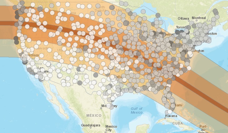
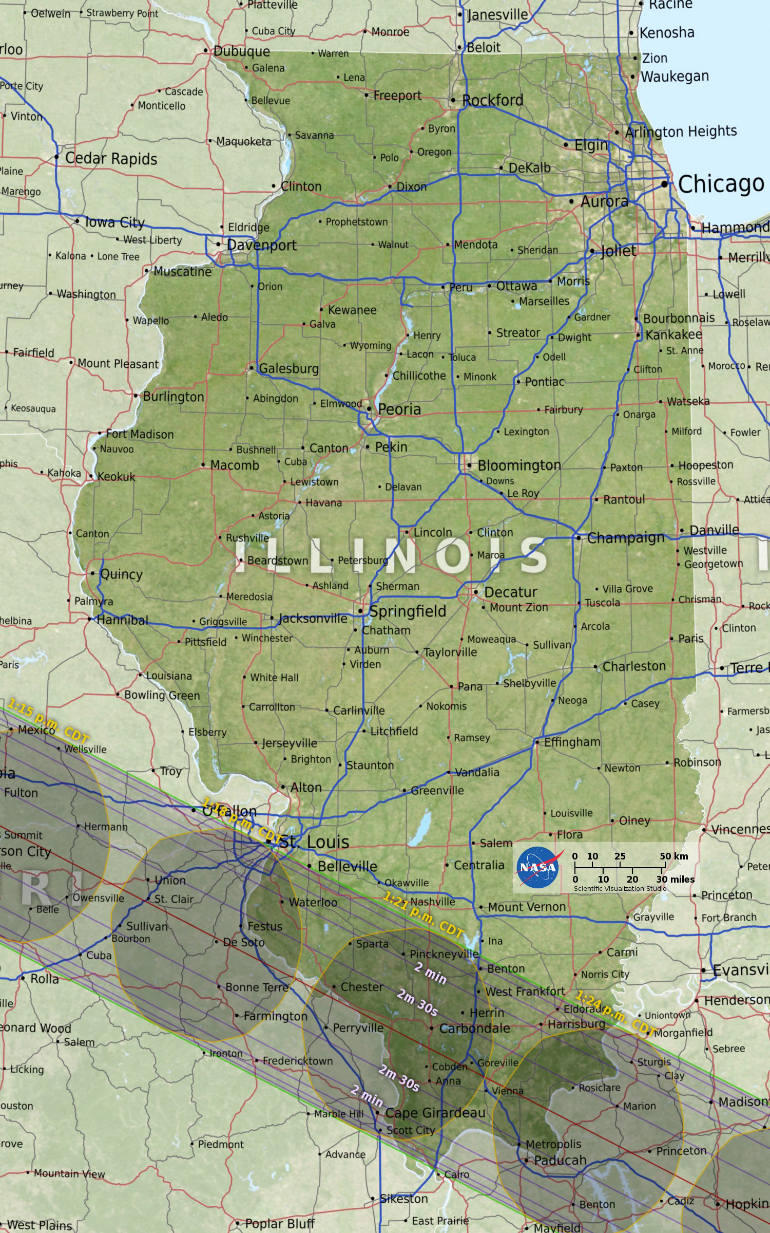
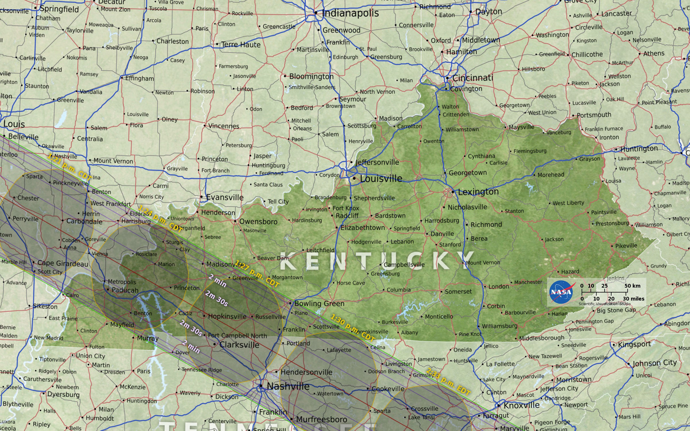
The maps below show the path of the moon's shadow during the total solar eclipse of Aug. 21:
States in path of totality
Oregon

Idaho

Montana

Wyoming

Nebraska

Kansas

Iowa

Illinois
Kentucky
Tennessee

Georgia

North Carolina

South Carolina

Animation shows how observers in Florida will experience partial solar eclipse
More maps on the web:
- The Eclipse Across America poster
- Animated map shows eclipse shadow
- NOAA graphics: Cloudiness during eclipse